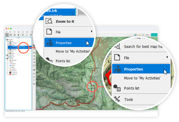
To access the properties of a file (track, route, waypoint or map), do a right click on it and select 'Properties'.
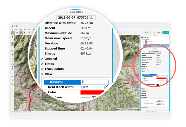
Each file has information associated with it. For example, a track has information about distances, times and speeds. Some of these properties are editable such as the line color, line thickness, icon…
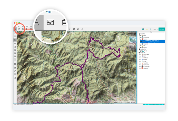
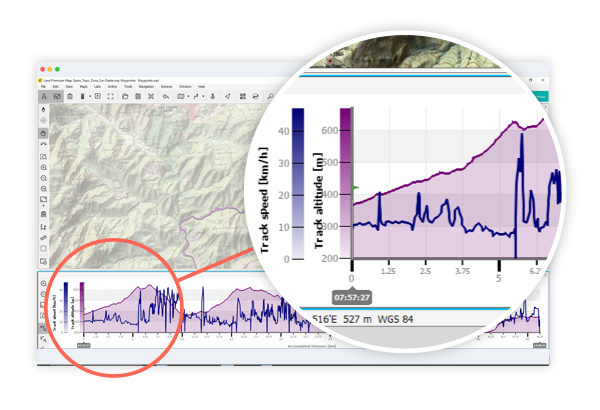
If you frequently work with tracks, press the 'Graph' button in the buttons bar and you will be able to visualise the corresponding altitude graphs.
Land graphs are dynamic, which means you can configure the vertical axis according to your needs. Click on the axis and change its default value (altitude) for another value you want to analyze: speed, pulsations, cadence...
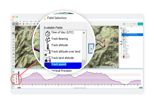
Additionally, you can also represent two fields in the same axis. Add them by clicking on the axis and selecting as many parameters as you wish.
In the following video you can see how to carry out all the previous steps.